Castle Peak
Castle peak is the tallest peak in the White Cloud Mountains. With an elevation of 11,815 feet, the peak sticks up a good amount above its neighbors. This tall peak can be seen from most the surrounding mountains for a good distance. It is easy to recognize due to a combination of its shape and the fact it sticks up above the surrounding mountains.
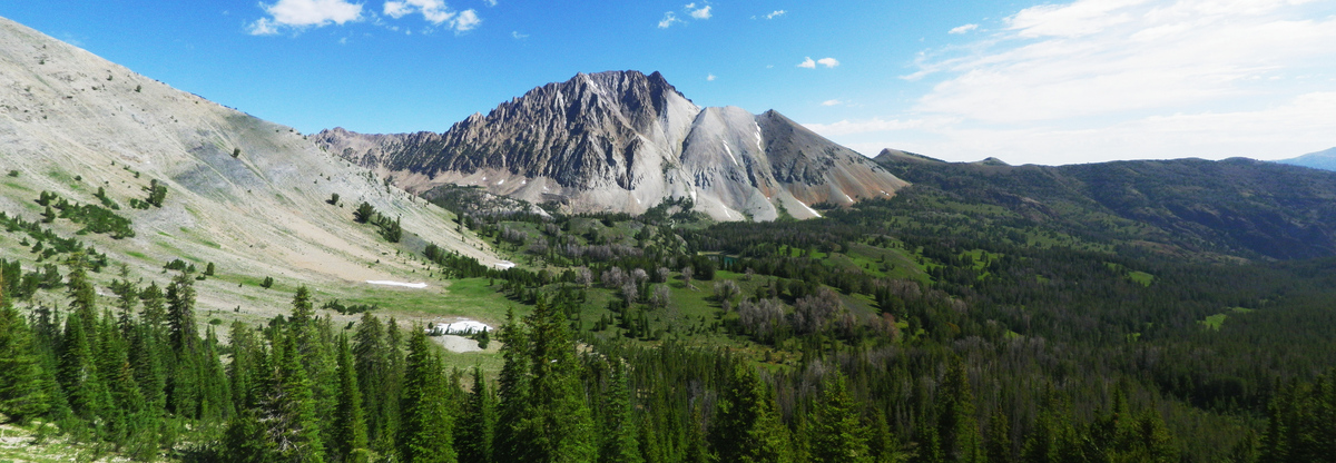
This photo looks over Chamberlain Lakes Basin below the peak and is taken from the trail that heads over to Washington Basin and makes its way to the trail head back at Fourth of July Creek. From this view you can see the standard route to climb the peak. You can see a gully that runs diagonally though the middle of the mountain from its base to the right of the peak upwards to the left end of the summit ridge. There is a mountaineer's trail that heads up through the loose white rock that disappears as you enter in the darker solid rock.
You follow the crack diagonally up about two thirds to three fourths of the way, but instead of following it all the way to the summit ridge, you can see another shadowy crack that runs vertically up the mountain, and can follow this to the summit.
I have climbed Castle Peak twice. This photograph comes from my Castle Peak in 2012 climb, and I also climbed Castle Peak in 2008. The 2008 climb I was atop of the mountain during sunset and have some good photos of sunset from the peak.